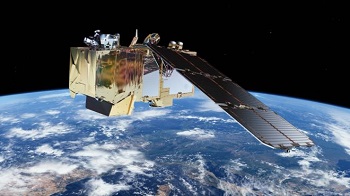
Scientists are developing a satellite system to record the temperatures of individual fields of crops.
The aim is to survey land temperatures to estimate water-use by plants and to show how they transfer that water back to the atmosphere.
The data will also help monitor how much water is available to grow crops and how they are responding to drought.
The new system is being considered for inclusion in the EU’s Earth observation programme, Copernicus.
It would be an addition to the Union’s ever-growing numbers of satellites it calls the Sentinels.
The main science goal is to benefit agriculture and increase crop production.
“Examining our planet and its environment for the ultimate benefit of people is so important with the ever-pressing global challenges we face, and remote-sensing from satellites is a key way to provide a consistent, global view that we can use to track and respond to both short and long-term change.” The researchers said
The LSTM system would be able to identify the temperatures of individual fields of about 40m across, more than 10 times as detailed as what is delivered by the current Sentinel satellite land surface temperature mapping
The increased precision would make land temperature much more useful for agriculture.
LSTM would enable researchers to calculate in real time how much water different plants required in different areas, and how often those plants needed to be irrigated.
It could also be used to help computer models predict drought conditions.As a first step, Profs are collecting aerial heat maps over London, and various agricultural areas.
He will be using one of the most sensitive airborne thermal imagers ever built – the Hyperspectral Thermal Emission Spectrometer (HyTES) – which will be flown on a Twin Otter aircraft.
These will be “gold-standard” images where details of ground conditions and the response of crops to drought are carefully recorded.
The data will then be used to design and calibrate the imaging system intended for LSTM.
The hope is that LSTM can become an operational spacecraft sometime in the next decade.
Lara Khouli

